Mera Peak
Acknowledgements:
Thanks to all the fellow hikers who have been supportive and have cheered me to this. Without the support from the Doers community, this would have not been possible.
The Alternative Routes:
1. You can fly into Lukla and Hike south to KhariKola which takes a day and half. Continue with the below detailed schedule provided.
2. You can fly into Lukla and Hike via Thuli Kharka which goes through high altitude. This will join the below schedule before Kothe.
Gangaji had booked the flights to Lukla, but we cancelled after discussion and took the road. We choose the below schedule as the road is more reliable than air, given the weather conditions.
The Schedule:
| Oct 1 | Drive from Kathmandu to Phaplu (2,413m/7,916ft), Distance: 265 Km, Duration: 7–8 Hours. We started early at around 6 am, and after the journey that lasted the entire day, through the winding roads, we reached safely before dark. |
| Oct 2 | Drive to Khari Khola (4–5 Hrs) and Trek to Panggom (2,846m/9,337ft), Duration: 3–4 Hrs, 12 Km. Our plan was to start early, but due to Vijayadasami, our start was delayed. Instead of having a private vehicle, we had to share, but were able to reach KhariKola by 3pm. The drive was so bumpy that I had back pain that lasted for the following 2 days. Had a quick late lunch and started to trek, Reached Panggom after dark, probably 7:30pm. There were leeches that got on to our pants, but were not bitten. |
| Oct 3 | Trek from Panggom to Ramailo Danda (3,276m/10,748ft), Duration: 5–6 Hours, Distance: 8 Km. It was a beautiful day with mild temperature and the journey started with a short uphill climb followed downhill until we reached lunch. We ended the day with a steep uphill that lasted for 2 hours. The lodge was located on top of a hill that overlooked the beautiful valley.  |
| Oct 4 | Trek from Ramailo Danda to Chhatra Khola (2,800m/9,186ft), Duration: 6–7 Hours, Distance: 12 Km. It started to drizzle, like fine mist and it pretty much lasted all day. We had to use the rain coat, and the path was muddy and slippery in quite a few places. There was a small steep section, where we had to use the chain/rope that was installed for safety. Our lodge was on the side of a river/waterfall on a slope. Today, a couple of leeches were successful in getting my blood. Our guide consoled us saying that they drink only the bad blood from our body 🙂  |
| Oct 5 | Trek from Chhatra Khola to Kothe (3,691m/12,109ft), Duration: 6–7 Hours, Distance: 15 Km. The misty rain continued, and the path never ending. I got wet from the water dripping through my sleeves. Luckily, the temperature during the day was above freezing and was not bothering too much. But, after 3pm, it was getting colder and couldn’t wait to reach and change. |
| Oct 6 | Trek from Kothe to Thaknak (4,358m/14,297ft), Duration: 3–4 Hours(incorrect), Distance: 7 Km. We finally got a break from the misty rain and had a pleasant day as we were walking in the valley, out of the woods. We could see the snow covered mountains coming into view as we walked towards them. We had samosas for lunch and dried out wet clothes and shoes in the sun during lunch. We reached Thagnak only in the evening. There was already snow on the ground due to the storm that happened a few days ago.  |
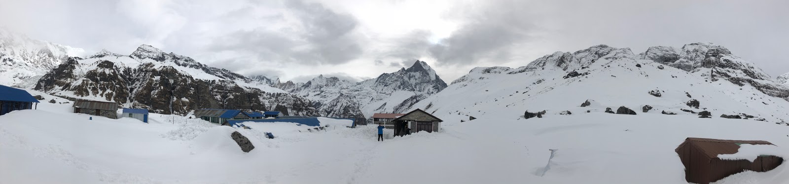
| Oct 7 | Trek from Thaknak to Khare (5,045m/16,486ft), Duration: 2–3 Hours(incorrect), Distance: 6 Km. There was snow on the trail as we started. Hiking for the sixth consecutive day and the altitude was giving me a hard time. When you walk on snow uphill, for every foot you climb, you lose a fraction of it as we slip down, and that was making it even harder. By the time we reached for lunch, I was almost exhausted. There was 2-3 feet of snow dumped in that area and getting cold. Gaining a little bit of energy from the break and lunch, when we came out, it started to snow and we had to put on rain gear and walk in with low visibility. I moved slowly and couldn’t wait to reach the lodge and by the time I reached, I was exhausted again. I was looking forward to my rest day as I was feeling the altitude taking a toll on my energy. |
| Oct 8 | Acclimatization and Pre–Climb Training at Khare. We started the day a bit slow. Tried the mountain boot and crampons and hiked up for an hour and returned back before lunch and relaxed in the afternoon doing nothing. |
| Oct 9 | Trek from Khare to Mera High Camp (5,780m/18,958ft), Duration: 6–7 Hours, Distance: 4–5 Km. Regaining energy, we started to High Camp. It was a beautiful sunny day with a blue sky. As the trail was snow covered, we were excited and motivated to put on the crampons from the beginning, but were asked to wait until the crampon point as we could unnecessarily drain our energy. After a couple of hours of walking the slope was getting a bit steeper and we were asked to put on the crampons. We were climbing higher and out of the valley into a vast white field of snow covered slope of the Glacier. The reflection of the sun from the snow was so bright and scorching any exposed part of our body. We could see the trail clearly marked on snow stretching for a mile or two by the footsteps of other hikers. Our Sherpa pointed out a rock up on the slope and said that was where the high camp is. He also said, it may look close, but a long way to get up there. And, it was. Slowly we inched and reached there before 3 pm. The view from this place was the best in the entire trip. You could see several high peaks including Mount Everest. It was higher above the clouds trying to sneak in from the valley below. Having drained out all the energy I had, I went and sat quietly at the dining table thinking of how much more I could pull through. I had an early dinner and went to bed with a midnight alarm.   |
| Oct 10 | Summit Mera Peak (6,476m/21,246ft) and back to Khare (8-9 hours) then Heli Shuttle to Lukla Waking up to the midnight alarm, I had some energy regained from a few hours of sleep between the tossing and twisting, lying down on an inclined floor. It took more than an hour to dress up and the Sherpa had to hurry us up as most of the other team were ready and going. They fed us some soup and we started probably around 1:30-2am. It was cold, with a very light breeze, but we had enough layers and started on the final important part of our journey. We had our harness on, and were tied to each other and we had to keep up the same steady pace. With a slow steady walk for about 4-5 hours, I reached the foot of the summit. The sherpa had to leave the backpack there as the path was narrow. He took his axe and assured me not to worry as we were tied to each other and we continued. It was a scary slope on one side and with heavy breathing and excitement reached the summit around 6:30am. We took pictures and started to return and reached back high camp before 10am. I was offered brunch, and for the first time on the trip, I didn’t feel like eating. All the strain that was put on the body started to show up. Guess what, no time to relax. Good weather, had to use the opportunity and get going. It was tiring and the trail never ending. Dragged the body somehow and reached back at Khare by 2-2:30pm. Called in Heli and they were arriving in an hour. Dumped all the things in our duffels and ran again to the helipad with pain reaching its climax. We couldn’t get any flights to KTM and had to walk again in Lukla for a few minutes to get to the hotel. The next day morning we took the flight to KTM to end the journey.  |
The Statistics:
Thanks to AllTrails. Over the period of 8days, the elevation gain was 23471ft and distance of 42.6miles. This is the trek from KhariKola to Summit and back to Khare. I did not record the Khare acclimatization day hike. I also missed for 2 hours on one of the days.
Similarities with other treks like EBC, ABC, Kili:
1. Long and tiring hikes.
2. Change in landscape as we get higher in altitude.
3. Rain in the lower altitudes, Freezing temperatures at higher altitude.
Differences:
1. Leech bites during the first few days of hiking.
2. Risky trails during the first few days of hike. It was too steep downhill as we crossed some waterfalls.
3. Cleaner bathrooms, compared to the EBC.
4. Less busy trails. EBC trail is a highway, this is a country road. The trail is narrow and less folks are seen.
5. Some places had 6inches of water flowing and we had to walk across them. Some places were muddy as well.
The Training:
As the schedule involves 6 continuous days of hiking without breaks, there is a need to have strong endurance. We did not hire personal porters and carried our day pack. 5 rounds of Cushetunk with 30lb for 2 consecutive days, helped me carry my backpack up to HighCamp. I was exhausted on Summit day, and had to ask my sherpa to carry my water bottles.
The highlight:
The trail up to Khare is no different than the other trips that I have taken. Initial days were through dense forest vegetation, traversing several waterfalls, leading to a valley, and we walked alongside the river in Hinku valley. The real deal is when you leave Khare for the High Camp. For 2-3 hours you walk in a valley surrounded by high mountains. The view is restricted by those mountains. Once when you hike up the valley… that is when the whole world reveals itself to you. A few snow covered peaks and as you climb higher, several more. Several 8000m peaks including Mt Everest, pop out behind you and cheer you as you hike up the Mera Glacier. The hike, all the way up to the HighCamp intersection is something that is hard to describe. Stunning, Fantastic, Marvelous … put all the words… it is still insufficient. Weather is an important factor, and we were blessed to have the best conditions.
The learning:
Even after multiple trips, we lacked the preparation to handle rain. I got drenched as water seeped through my hand opening as i was raising my hand to climb uphill.
The myth:
Several folks still believe that there is mountaineering / technical ability required to do this trek. All you need is a mountaineering boot with crampons. If you are trained with this, you are good to go. On the summit day, my sherpa and I were connected by a rope for the entire journey. I felt it was an overkill. It was really useful just for the narrow path, 5-10minutes, close to the summit, where there was a steep slope.